Chappaquiddick on Bayou St. John – New Orleans, La.
Michelle M. Haensel Memorial Web Site
Bayou St. John
New Orleans, Louisiana
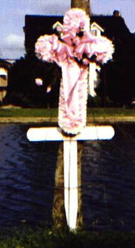
Follow link to see the pictorial record of memorial crosses at the homicide scene located at the intersection of Fredricks Street and Wisner Boulevard (New Orleans, Louisiana).
Bayou St. John History
Bayou St. John (New Orleans, Louisiana) is the remnant of a natural navigable
waterway which once connected Lake Pontchartrain and the Mississippi River. The
area was originally inhabited by the Chapitoulas Indians. However,
they were gone by the time the French arrived. The Choctaw Indians used the
Bayou as a travel and trade route for many years prior to the arrival of the
French. In 1699, the Choctaw showed the French how to reach the area now known
as New Orleans without having to traverse the dangerous and mostly uncharted
Mississippi River. The original route started at the Gulf of Mexico and went
through the Manchac Bayou (once called the Ascantia River), then through Lake Maurepas,
then into Lake Pontchartrain to a stream on the south shore of the lake
which the Indians called Choupicatcha (also reported
as Tchoupic). In Choctaw this word means mudfish. The name Tchoupic (pronounced shoe-pick)
is still used to describe a popular local fish in the region. The French named this
stream Bayou St. John in honor of the patron saint. Later trips by the French
followed a different route from the Gulf of Mexico. The new route went through
Lake Borgne, the Rigolets
Pass, then Lake Pontchartrain to Bayou St. John. Upon
traveling up this bayou, one reached a terminus still located near the current
intersection of Desoto Street and Lafitte Street.
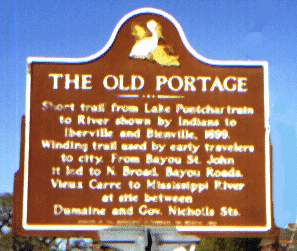
From there, a portage of about 2 miles through dense forest and marsh brought
one to the Mississippi River.
The French
began using the new route for trade. As early as 1703 (15 years before the
founding of New Orleans), the Bayou was used as a shipping channel for French
trappers and traders who lived on the Bayou. Prior to the arrival of the
French, a Choctaw Indian village of the Houmas tribe
existed at the headwaters of the Bayou. They had probably already relocated to what is now called Houma, Louisiana by the time
the French arrived. The French established a landing at the headwaters and
named it Port St. John when the City of New Orleans was established. A land route to
the new City on the river was cleared and named Grand Route St. John. A street bearing this name still exist to memorialize this
route. In 1701, the French constructed a fortress near the mouth of the Bayou.
Under Spanish rule in 1779, the fort was rebuilt and became known as Spanish Fort. Remnants of
the structure still exist. Local folklore says that the voodoo queen, Marie Laveau, performed voodoo at the mouth of Bayou St. John on
Lake Pontchartrain.
Bayou St.
John was fundamental to the early life of New Orleans. In 1803 a canal was
dredged from the Bayou toward the City's heart. This new canal terminated at
current day Basin Street named for the ship turning basin at the terminus of
the canal. This canal was originally called the Carondelet Canal in honor of
the Spanish governor of that name. In 1838, a new canal under American control
was dredged from Lake Pontchartrain into the City. The new canal was known as
the New Basin Canal. The Carondelet Canal became known as the Old Basin Canal
and remained primarily under the control of the Creoles. Eventually, Bayou St.
John and the Old Basin Canal became commercially less important. The Bayou St.
John has not
been navigable since the early 1900's. Construction of vehicular bridges and
changes in commerce rendered the Bayou unsuitable for water traffic except for
very recreational use of canoes, kayaks, and small skiffs.
Many geologist believe Bayou
St. John is the result of a geological fault or fracture in the ground surface since
it is bankless. When the French arrived in Louisiana, Bayou St. John was connected to the remnants of Bayou Sauvage and Bayou Metairie. Bayou Metairie is an ancient
distributary of the Mississippi River. In its prime,
Bayou Metairie had a depth of
from 50 to 60 feet below present ground surface. Some believe that Bayou
Metairie and Bayou Gentilly-Sauvage flowed as one
stream originally. These connections do not exist today. The Bayous have not
been connected to the Mississippi River in modern times due to the
changes in the course of the Mississippi River. Also, Bayou St. John is no longer directly connected to Lake
Pontchartrain. A manmade control structure existed just south of what is now
Robert E. Lee Boulevard until 1960. At that time, Robert E. Lee Boulevard was
constructed and a new "water fall" control structure was constructed
just north of the roadway. This structure regulated the flow of water from Lake
Pontchartrain into the Bayou. This flow was necessary to maintain the
ecosystem. The Bayou is not tidal today. A control floodgate now exists at the
terminus of the bayou at Lake Pontchartrain. The floodgate's purpose, when in a
closed position, is to prevent tidal water from Lake Pontchartrain from
entering the bayou
when the water
level in the lake rises
during tropical storm events. The Bayou
St. John has a length of less
than 5 miles, an average width of 200 feet, and a maximum depth of approximately 9 feet.
The Bayou
is not part of the New Orleans Sewerage and
Water Board’s stormwater drainage
collection and storage system as the only rainfall it receives is that which
falls directly on the water surface and on the immediately adjacent banks. In
fact, the Sewerage and Water Board does not own or maintain the Bayou. The
Sewerage and Water Board allows water to flow through three (3) controlled
outfalls into the City's stormwater drainage system.
The outfalls are located at the Orleans Avenue canal, the Lafitte Street canal
and the Florida Avenue canal. The Orleans Avenue canal outfall is normally
maintained in the open position. The other two outfalls are normally in the
closed position. The outfalls are not capable of draining the Bayou only
maintaining the surface water elevation within an approximate range of (-)1.0 ft. to (-)1.5 ft. below mean sea level. There also
exist a drainage pump which can exchange water between Bayou St. John and the
City Park Lagoons.
In 1993, a
new floodwall control gate was constructed by the Orleans Levee Board north of
the Robert E. Lee Boulevard crossing. The floodwall gates remain normally
closed. However, the gate contains sluice gates to allow water into the Bayou.
The old Bayou "water fall" control structure was then deactivated and
remains in the open position. All inflow is now regulated by the new sluice
gates. The Orleans Levee District
controls the operation of the sluice gates. Normally natural water bodies are
owned by the state. However, it is believed that Bayou St. John
is owned by City Park.
City Park has established rules for the use of the Bayou in regard to power
boats and recreation. City
Park also maintains pumps which allow for water to be exchanged between the Bayou
and the City Park Lagoon system. Today, Bayou St. John is neither
tidal nor controlled by fluctuations of the water surface in the Mississippi
River. The water surface elevation is controlled by manmade pumps and control
structures.
For more information about this memorial web site, contact Cookie and Bill Haensel at shaensel@cox.net or by telephone at (504) 454-3905.